OS paper maps
Recently a hill walker told me that he didn’t carry OS maps when walking the Welsh hills, relying completely on his ‘OS Maps’ app on his smartphone. I was surprised.
Now, I too think the OS maps app is very good for fixing a position, but it’s not bomb proof. Your smartphone might run out of battery, the app might not work, you might lose or damage your smartphone - there are all sorts of reasons why placing total reliance on gadgets is taking a gamble. Most days you will probably get away with it. But one day you won’t.
Also, there are some things that are more easily done on a paper map, such as taking the bearing of an ‘aspect of slope’, an important technique when navigating in the mountains, particularly if visibility is bad.
Using an OS paper map is one of the delights about walking in the UK. I can’t remember seeing a map in another country as good or as detailed.
I have been using OS maps since the early 1970’s. My final school exams (‘A’ levels) included questions that required one to know how to read a map. I remember the two questions in the Physical Geography paper: Firstly, From the OS map, identify the rock types and compare and contrast the features of each. The answer was limestone and millstone grit. The map was the Peak District in the Pennines. The second question, again from an OS map, asked candidates to describe upland glaciation features and compare them to lowland glaciation features. The two OS maps were in North Wales.
The 1:25,000 scale maps were in the Pathfinder series. I have c. 30 pathfinder maps, which I still use.
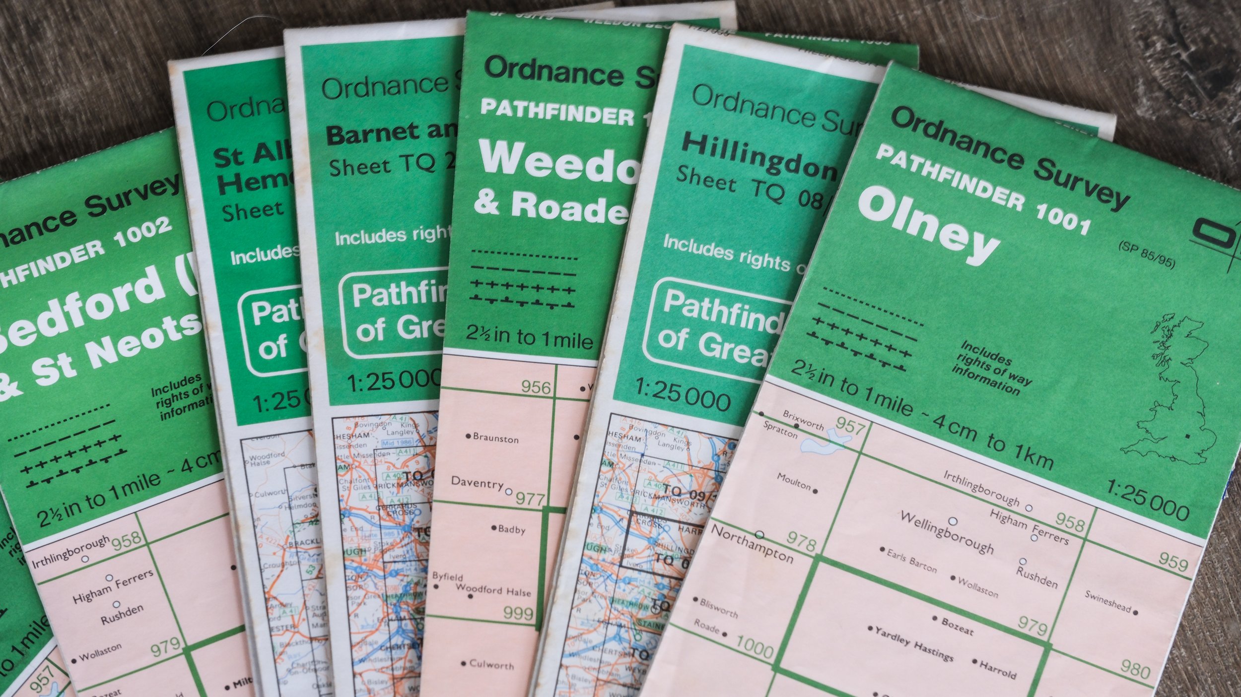
Pathfinder 1:25,000 OS maps
The Outdoor Leisure 1:25,000 series of maps were created to cover popular walking and national park areas (e.g. the Lakes, Snowdonia, the Peaks). Because they were designed specifically for recreation, they often included an emphasis on footpaths and access land, sometimes with additional symbols for tourist or outdoor features. These maps were yellow.
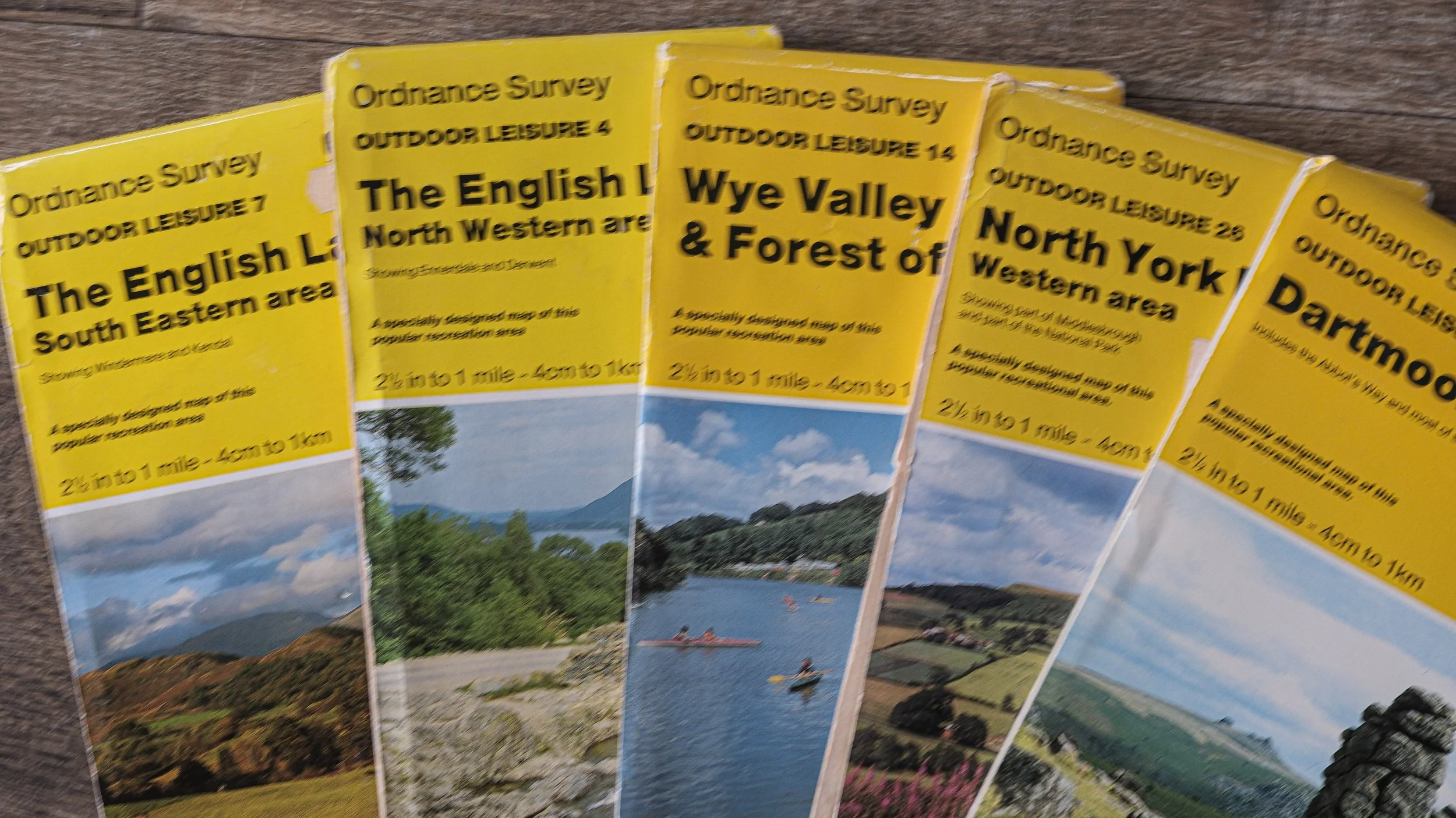
Outdoor Leisure 1:25,000 OS maps
The Explorer series of 1:25,000 maps were introduced in the 1990s to replace both the Pathfinder and Outdoor Leisure series with one unified 1:25,000 map family. The cartographic style, symbols, and colouring were standardised across the country. When the old Outdoor Leisure maps were reissued as Explorers, they were given the same orange design but kept their “OL” numbering and a small yellow flash on the corner of the cover (a nod to their origins).
Today the situation is as follows:
Both “OL” (yellow-marked) and standard “Explorer” (orange) maps are printed with the same data, same level of detail, and same update schedule.
The only differences now are:
Sheet shape — OL sheets may have irregular boundaries.
Labeling — OL sheets retain their “OL” numbers for continuity (e.g. OL6 – The English Lakes, South Western Area).
Cover design — still shows the little yellow flash.
Maps have become clearer to read. Compare the following:
The first map below is from a Pathfinder 1:25,000 map dating back to the 1980’s. The second is of the same area but in today’s Explorer range.
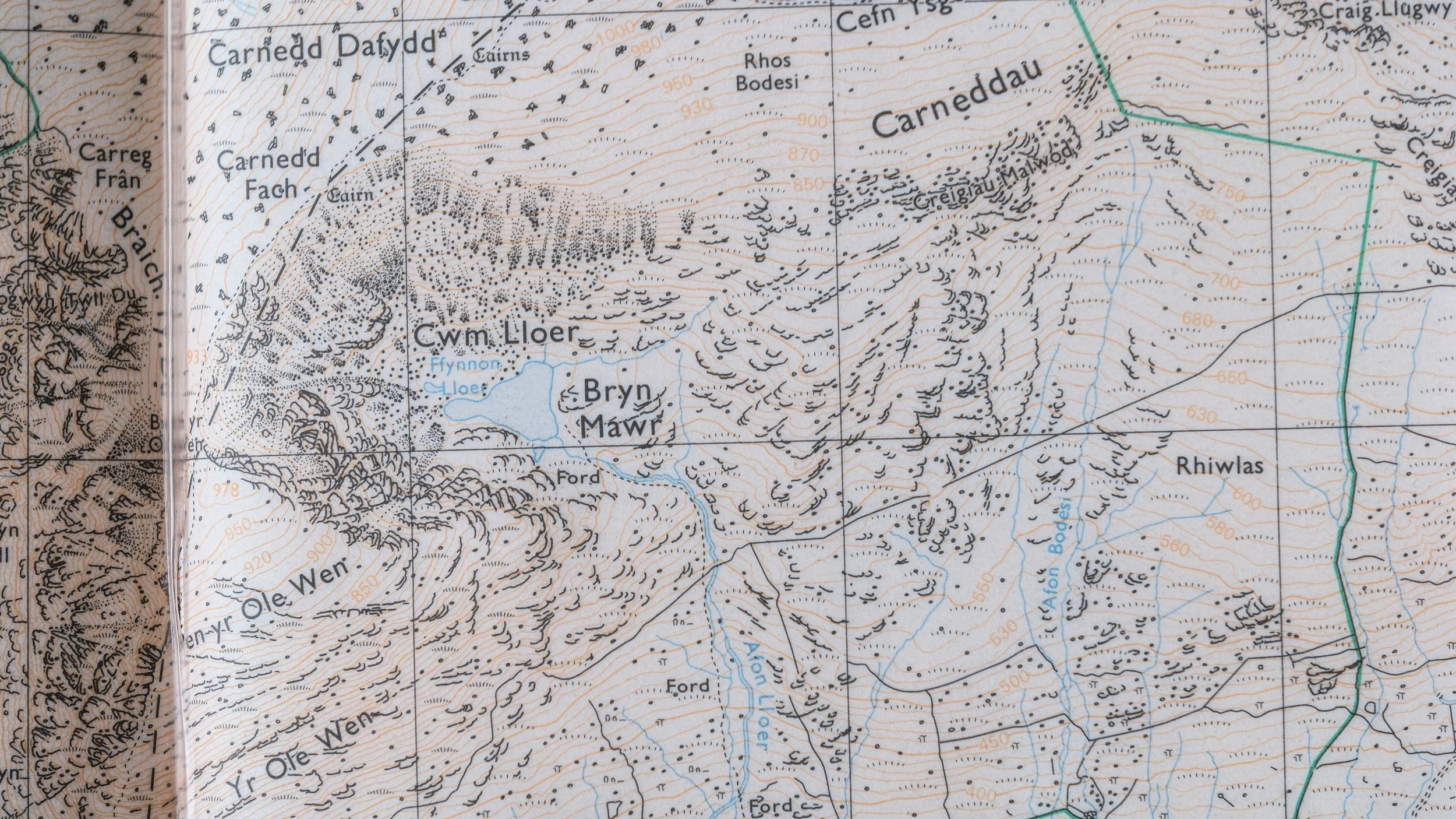
Cwm Lloer, Pathfinder 1:25,000 1980’s

Cwm Lloer, 1:25,000 today’s Explorer range
The Explorer range is clearer to my eye and easier to use. For example counting contour lines to estimate the time required to reach a certain point is more easily done on the Explorer range.
It’s also very helpful that you can buy custom maps to save on carrying more than one map in the event that an area of interest straddles across two map regions.
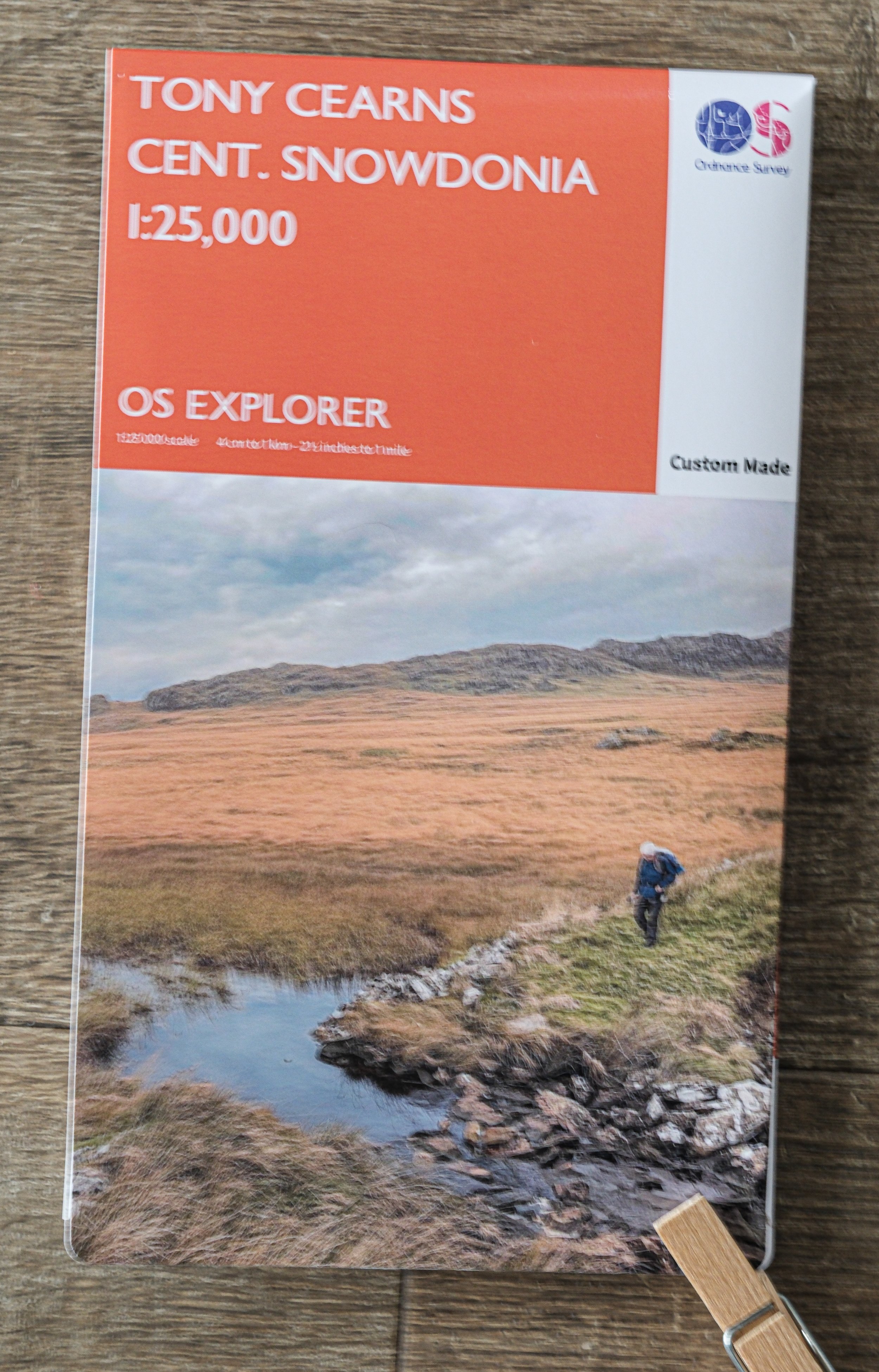
I have a custom map of central Eryri (Snowdonia) to avoid carrying two maps.